

19 Dec Hiking in Slovenia: Triglav Peak – This is Amazing!
The hike to Triglav peak will take you to the highest top in Slovenia and in the Julian Alps mountain range with an altitude of 2864 meters and it represents the symbol of this small nation. The first mentions of the peak are from the 14th century under the name of Terglau which is derived from “Tri-golvъ” that literally means three headed or three peaks. There are many different paths you can take to ascend the mountain but we chose the one on Krma Valley, which at that time was the easiest and with the least amount of snow.
Distance
26 Km
Total Time
14 h 00 min
Active Time
12 h 26 min
Vertical Relief
+2000 / -2000 m
Min/Max Altitude
920 – 2864 m
Average Speed
2.2 km/h
Hike to Triglav Peak
We decided to camp as close to the starting point of the hike as possible in order to have an early start in the morning and as such, we chose Camping Kamne. It is one of the nicest campings we have been to in Slovenia, really peaceful, clean, with lots of grass and plenty of shade.
After checking in we were talking to the owner about our plan to hike to Triglav peak in the morning. We were really surprised when she told us that the main valleys still had a pretty consistent layer of ice / snow and that ice peaks and crampons are more than advised.
Prior to our arrival, there were some tragic accidents that involved tourists trying to get to the peak. Since we had no ice gear with us and to rent some was out of the question as all stores were closed at that hour we decided to check what the internet had to say. No luck there so we thought about calling the people at Kredarica chalet, located right under Triglav peak. The guys there told us that you can reach the chalet and the peak on one of the following 3 main valleys: Vrata Valley that takes you near Aljazev Dom (the most picturesque and renowned track), Kot Valley and Krma Valley.
The first two options were out of the question because of snow and the last, Krma Valley, was the best alternative and presented no real danger. That was all we needed to hear, so with a smile on our faces, we packed our gear and prepared everything we needed for the next morning.
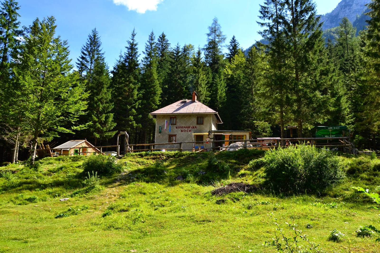
In order to reach the starting area of the hike from Dovje, we drove to Kovinasrka Koca (koca means chalet) by passing through Mojstrana and Zgornija Radovna.
The man at the chalet informed us that we can still drive on the road for about two more kilometers until we reach a parking place where we need to abandon the car.
After one kilometer we found a small fence and thought that there we should park, but you can continue for one more kilometer without a problem. The road, even though it is made out of gravel is manageable for almost any type of car.


From the parking spot the path goes on for about 4 kilometers into the forest, up on a small slope. This section took us about 1 and a half hours at a relaxing walking speed.
After this, the next part is on gravel and takes you through juniper fields all the way to a chalet located at the base of Kurika peak, at 1767 meters altitude. We took a resting break here as it was already midday and the temperature was pretty high.
We continued past the chalet on the same red dot marking and we reached two water sources where we can resupply. Also, we reached our first intersection that splits into different destinations, but nothing to worry about as everything is really well marked and you have signs pointing you in the right direction.
Among other things please meet the Slovenian alpine cows.
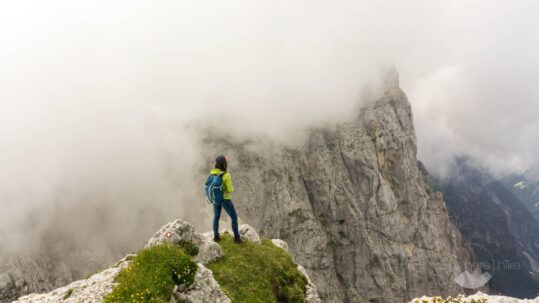
The landscape changes again as rocky cliffs start to take over the horizon; we have reached the upper alpine fields.
We are starting to see the landscape we were hoping to find and also we are starting to encounter the first patches of snow but nothing too difficult as most of them are on flat ground.
After about 7 kilometers the slope gets a level up in incline. Also, we have passed the 2000 meter altitude marker.
Just 3 more kilometers and 500 more meters in altitude and we should reach Kredarica or Triglavski Dom – 2541 meters – the place where we will rest for the night.
As we are closing in to our destination the clouds are also starting to group up above our heads – this was not in the master plan!
When we reached the chalet the sky was black and there were lightning bolts and thunder all around us.
It was pretty clear that it would be wise not to be on the highest point with all the lightning around so we decided that we will remain at the chalet today.
We had a beer and made a photo shooting session with the clouds around and went to bed hoping that the next morning will look a lot better than what we were seeing now.


The hike through Krma Valley is the longest of the three but it is also the less difficult one. The track is mainly on footpaths of dirt or gravel with no via Ferrata at all.
Karina was restless all night and was eager for the morning to come. At 6 AM she was up and went straight to the window to see how the weather was looking outside and it was beautiful! The sun was shining and there were only a few small clouds that seemed not to bother us.
We got up and prepared our stuff for the hike as fast as we could. After we enjoyed our kettle coffee at 2500 meters we were ready to go. The lady at the chalet told us that in 30 years since she was there they never had such a rough winter with such big amounts of snow, which made us wonder what we will find on the remaining hike. One week prior to our arrival it snowed at Kredarica in early July and next to the church there still was about a meter of thick snow.
Right at the start, we were greeted with a snow patch that was testing people’s balance. When descending most were practicing the butt sliding event. On the other hand with the help of trekking poles, we had no problem.
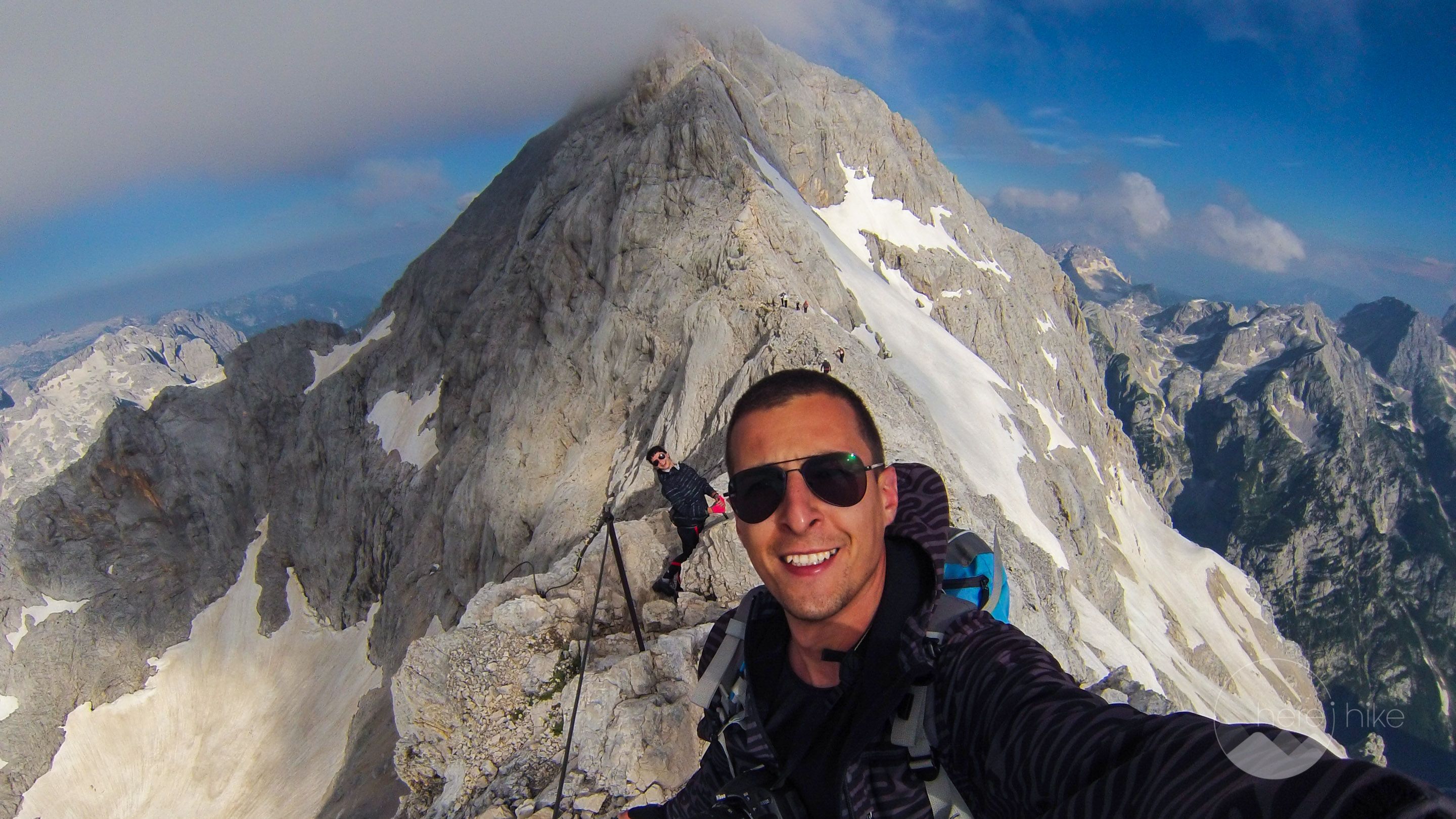
After that up next you’ll start the via Ferrata section that is simply fantastic. From lower altitude, you will think it is difficult but when you are there it’s pretty easy; don’t overestimate your skills as a simple slip can turn into an accident. You don’t need any special Ferrata equipment but I recommend getting some warm clothes and some Ferrata gloves. Also, a helmet wouldn’t be bad either as the track is pretty crowded and there is the chance of falling rocks.


From Kredarica to the peak of Triglav you will need about an hour but if you plan to take a lot of photos the timings can be bigger.
The weather was great and the clouds that started forming close the peak had their charm as well, but as usual they also followed us on Triglav. Even so, we had a great view from the top of Slovenia and the landscape is simply mesmerizing, full of rocky edges wherever you turn your gaze.
From here we will go downhill all the way, for about 12 kilometers with more than 2000 meters of altitude difference. Even though it isn’t that difficult it will get pretty demanding on the knees especially closer to the end. Going back we chose the same way we came as it was the only accessible road that didn’t require special snow equipment.
All in all, this has been one of the best peaks we have visited and at that time it was:
- The highest peak we have climbed (so far back then): 2864m
- The most demanding descent (so far back then): -2000m
- The highest accommodation: 2515m
- Our first real via Ferrata
- Earliest peak reached: 8 AM
- Fastest ascent (so far): 1700m in 5 hours and 15 minutes
In the evening, when we reached the camping in Dovje, the host had organized a traditional Slovenian evening with food, drinks, music and traditional clothing, all for free. It was a pleasant and relaxing surprise after our two day hike.


GPS track to Triglav Peak
How to get to Triglav Peak?
Triglav peak is located in the middle of the Triglav National Park in Slovenia, on the western part of the country. It is pretty easy to find as there are a lot of signs pointing you in this direction and from Ljubljana, the capital city, you have a motorway / express road almost all the way.
Where to sleep?
If you are looking for a great place to sleep at the base of the Triglav National Park then look no further than Camping Kamne, one of the best campings we have been to in Slovenia. Besides the fact that it is really clean and peaceful the price is also really affordable, at 19 euros per night for two persons, one small tent, and one car. You will need to pay the hot showers extra but it is only 0,5 euro for 4 minutes of hot water (2014 prices).
For Triglav the best place where you can sleep is at Kredarica – Triglavski Dom located right below the peak at 2541 meters altitude. The chalet has a capacity of 300 spots but don’t leave without a reservation as it gets crowded in the summer. We did our reservation two weeks in advance and had no problems. The place is really nice as they also serve food and drinks but for a somewhat bigger price, a thing that is normal taking into consideration that the only way they can resupply is by helicopter. We have paid 23 euros / person/ bed in a mixt 14 person room. As a reference a beer is 4 euro, a coffee is 2 euro, a sandwich is 4.5 euro and a soup is 3.5 euro. Don’t expect a hot shower as the water is ice cold in the bathrooms. Personally, I have not seen any showers but possibly they exist.
Good to know
Before you leave check the weather forecast as it can get dangerous if a storm catches you in the open. Also, try to find out how much snow is left on the valleys and choose to appropriate route based on this information. The hike can be done in one day but you require an early morning start, a light backpack, and a good physical condition.
At Kamne Camping in Dovje, you can find bread and pastry products each morning when a local car comes and stops for a few hours. The products are always fresh and really good. For other meals, you will need to go to one of the restaurants in the village. For the hike to Triglav, you will only find food at Kredarica chalet so all other snacks you should carry with you. During the hike, you will find water when you are entering the alpine area at 1767 meters altitude near a chalet. The other source is at Kredarica.
There is no visiting tax in the Triglav National Park.


Hope you found the information helpful and accurate, but remember, if you have any questions drop them in a comment below!
Other great adventures
-
Hiking in Slovenia – Aljazev Dom – Kriz Peak
Slovenia is one of those countries to which we return time and time again and which each visit we discover something new and amazing. Even though it is not particularly large it has some fantastic lan...
-
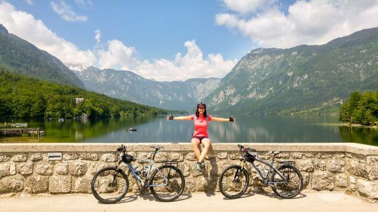
Bike Trails in Slovenia – Around Bled and Bohinj Lakes
Discover four road bike trails in Slovenia around the wonderful area of Bled and Bohinj lakes. Slovenia itself is a Paradise for cycling and when it comes to things to see there you'll be amazed. We s...
-

Hiking in Slovenia: Triglav Peak – This is Amazing!
The hike to Triglav peak will take you to the highest top in Slovenia and in the Julian Alps mountain range with an altitude of 2864 meters and it represents the symbol of this small nation. The first...
Unknown
Posted at 15:19h, 11 Januarygreat pics!
Charles Eggleton
Posted at 22:03h, 19 FebruaryGreat Post! Awesome Pictures, did you actually use Via Ferrata EQP or just hike up without? Cheers
Karina Isar
Posted at 22:06h, 19 FebruaryThanks Charles 🙂
No via ferrata equipment is needed for this option, we only had some bike gloves but you can do it without them as well. Te real via ferrata is on another valley and for that part I understand the equipment is mandatory.
Cheers!
Karina and Alex
Natasha
Posted at 14:39h, 15 MayGreat pictures and information, thanks. My husband and I are planning out trip for this summer. Having never done a via ferrata and having a fear of heights, do you think this would be easy enough for me to achieve?
Karina Isar
Posted at 22:04h, 15 MayHello Natasha,
Back in that time I didn't have any experience in via ferrata and I myself still have a fear of exposure rather than heights. I would say is more than manageable so go for it! I am 100% sure you won't regret it! 🙂