10 Oct Korab Summit – Highest Peak of North Macedonia and Albania
The hike to Korab Peak, the rooftop of North Macedonia and Albania, has been on of our list ever since we first attempted it a few years ago and we abandoned it mid-way because of huge quantities of snow and a little bit of stormy weather. But we are back and we will conquer you this time!
Distance
17 Km
Total Time
7 h 00 min
Active Time
6 h 21 min
Vertical Relief
+1300 / -1300 m
Min/Max Altitude
1500 – 2770 m
Average Speed
2.4 km/h
Hike to Korab Peak
We went all in on this hike because the previous day we had hard rain and storms in the area and the forecast for our ascent day didn’t look any better. Because the weather at the mountainside is ever changing we decided to go to Strezimir, sleep there for the night and see how it looks like the next morning. If all is well we will go do the peak and if not we will drive to Mavrovo Lake and do car tourism.
It rained all night with hard winds blowing all over the place and the next morning when I opened the tent I wasn’t sure what we should do. The pale sun was trying to heat the wet earth from behind the clouds that made us uneasy: were they going away or were they bringing some more ‘brothers‘?
We kept having conflicting thoughts about going or not going… We had breakfast and we started inclining more and more towards hiking! The final decision was like: “What the heck, let’s see how far we can go”, so off we went to Korab!


One day prior to this we had a chat about the hike with the mountain guides stationed at the Movrovo Anovi tourist info center. We found out the track isn’t technically hard, but it isn’t that easy either. The good part is that there are tons of markings and on top of that we are also using a GPS navigator with the track (we took safety measures after the experience we had at Titov Peak).
We did our warm up on the uphill path that starts behind the border watchtower and that goes up through the forest.
After leaving the forest behind in short time you will reach a sheepfold so be careful with the dogs as the path takes you close to the sheepherder’s home.
After 10-15 more minutes of walking, you will find the last fresh water spot so take as much as you need. Here is where the path starts to become more and more appalling to the eye.
The ascent is relentless and still Korab is not in sight. The view you will encounter the first time you do a hard right will leave you breathless as the scenery changes dramatically and you find yourself surrounded by rocky mountains.
We are half way on our hike and it seems that the weather has stabilized and the path we are now on is almost flat stretching through an impressive glacial valley on the left side, with razor sharp mountain peak in the distance. It is hard to find only one point to stare at.
Later we encounter Korab peak in the distance, situated on the right side of two sharp mountain tops. So close and yet so far, we still have some distance to cover.
The final ascent is done on the left side of the peak and it isn’t difficult at all. Even if we hiked in mid-June we still found plenty of snow patches but nothing that would require any special equipment.
We were lucky it seems as this year’s winter was milder than the one four years ago. Then the whole valley was covered in a consistent layer of snow even though it was the middle of summer.


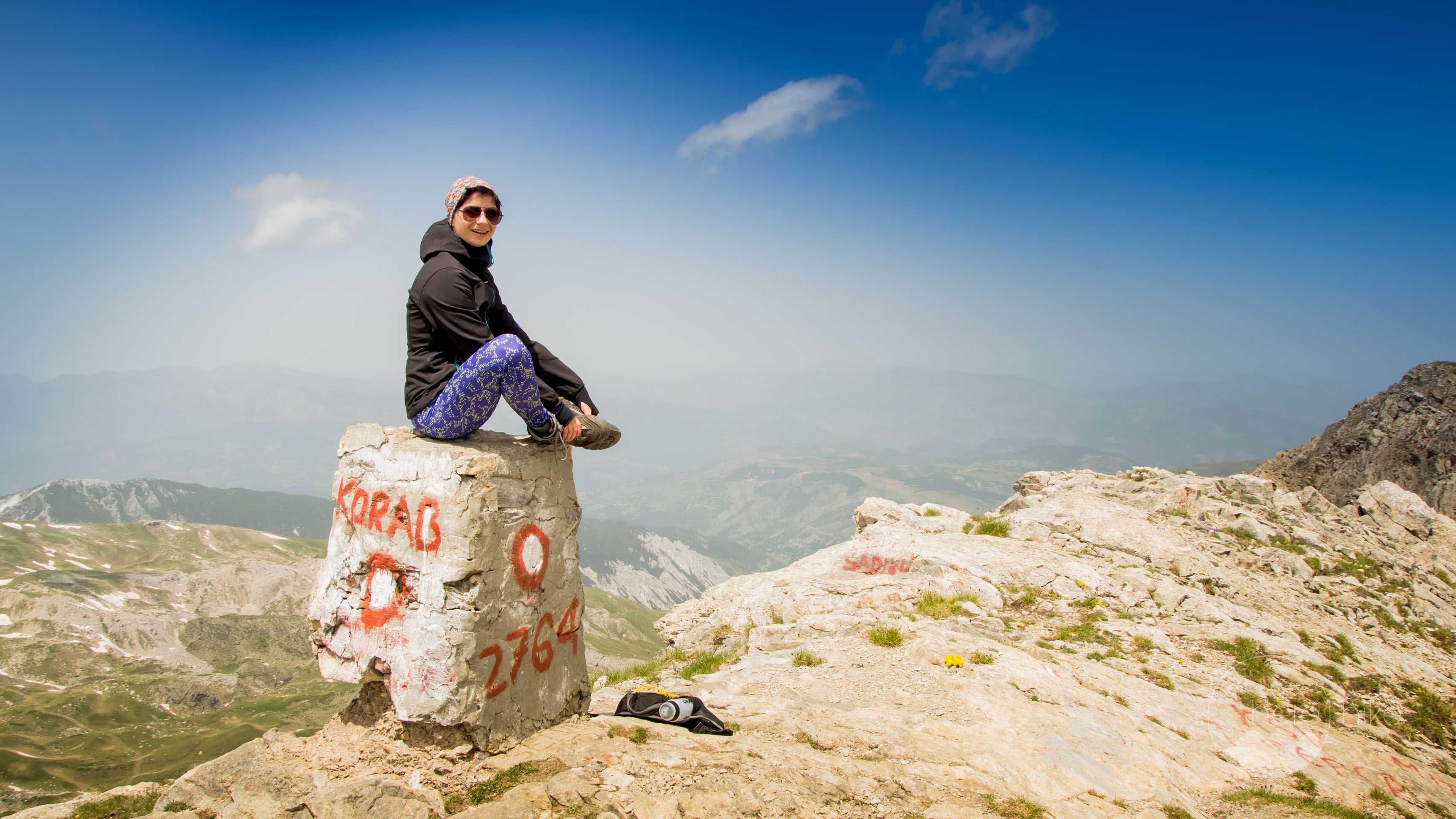
Finally, we reach Korab with its 2764 meter! Yay, achievement unlocked! This has washed some of the shame we managed to produce on the way to Titov.
We managed to do this hike in good time, under 4 hours for the ascent, but our knees started aching on the descent and almost froze when we had a close encounter with some sheep dogs. The problem was that the sheepherders were far away in the valley and the wind was blowing from behind us, as such the dogs noticed our presence early on.
We stayed put for about 20 minutes, just looking at the dogs that were getting closer and closer until the sheepherder made his way up the mountain to us. Even though the man was calling the dogs back they had no problem with that and were only getting more aggressive. From time to time they were looking back to see where their owner was while continuing to bark. As soon as the sheepherder reached us they stood down, deactivated. We received an escort through the sheep heard and then were on our way.
If you thought Romania has a lot of sheep and sheepfolds wait to see North Macedonia! Chaos! Everywhere you look there is a sheepfold or a sheep herd and for each herd, there are like 6-8 big, fearless dogs.
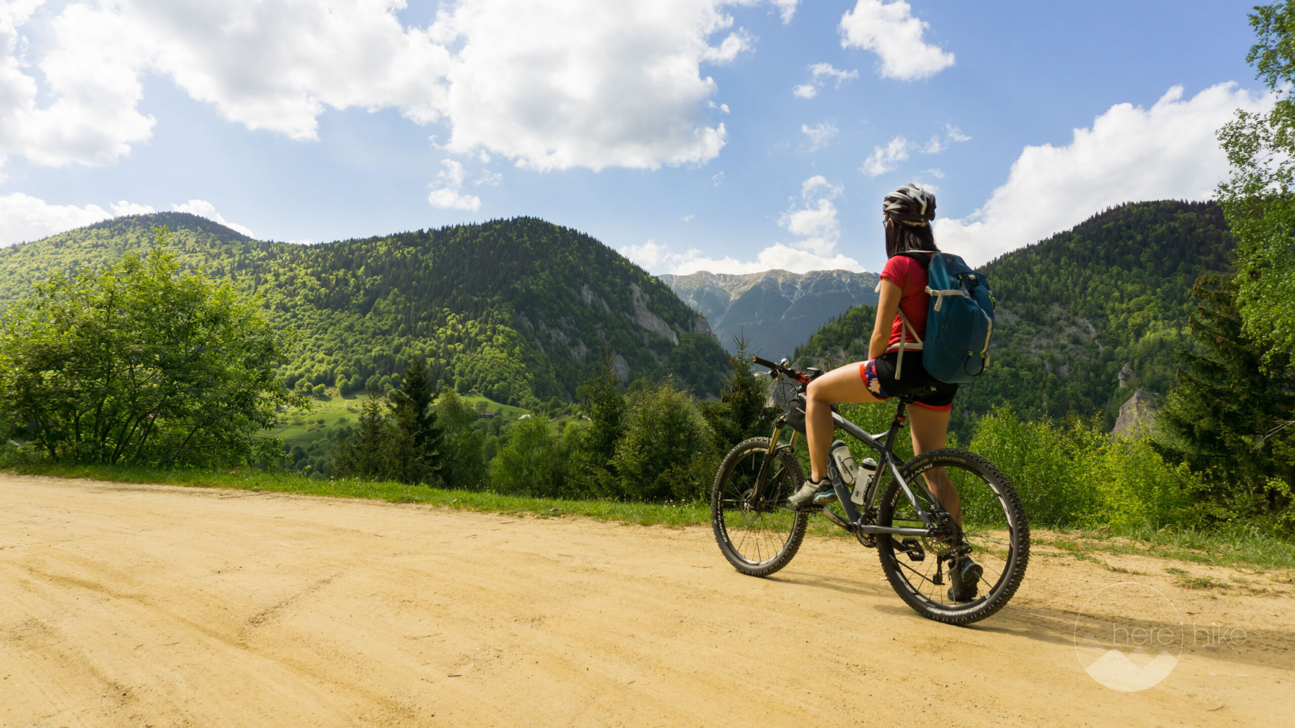
You have to hike carefully because things are serious. We are definitely not going to come here with our bikes even though we did find some really nice areas that had a lot of potential! 🙂


GPS track to Korab Peak
How to get to Korab Peak?
Where to sleep?
It’s a done deal! Should we recap some details about the hike? So, it’s a border area and the first thing you need to do is go the border guard and let him know you want to go to Korab (usually he will come and ask you what is your business). Another important thing is that you need to pay a visitor tax for Mavrovo National Park. You can do this at the visitor center in Mavrovo Anovi from 09:00 to 18:00 and as far as we know you can’t do it anywhere else that is close by (if your schedule doesn’t allow you to go and pay the tax it’s not a big problem, it’s more like showing your support).
From Skopje, we drove to the west part of North Macedonia where Mavrovo National Park is located. Our final destination point is Strezimir Watch Tower, a border watchpoint, where we will be sleeping for the night in our tent.
From Volkovija we are going to do a right turn and we will get off the asphalt road for some time. This section is 14 kilometers long and you will need approximately 1 hour time to do it with a small car. For off-road cars, it’s a piece of cake. About half way you will reach the first border point where it is mandatory to stop and to show your IDs to the state authorities (in this case the border police).
Four years ago we followed the same route all the way to Strezimir, the second border watchtower, where we set our camp (there is no other feasible spot where you can place your tent on the way). The only difference, this time, was that we found more garbage and the outpost was empty, no one was home. Apparently, they moved to the other border point, but I can’t say if it was only temporary or permanent.
Another thing: you have no facilities here like a toilet, water or other stuff but it is the best place to camp if you want an early start in the morning.

Good to know
Before we left for home we wondered a bit more in North Macedonia around Mavrovo and Debar lakes. We had a great time, found some nice spots for some early morning yoga right above the lake.
Do remember that for this hike there are no real camping places in the area. You can do some wild camping or next to the border control hut. Also, no toilets, so be prepared.
Come with your own food and drinks as there are no huts from where you can buy. During the summer month I would not rely on springs for water as they might dry up.


Hope you found the information helpful and accurate, but remember, if you have any questions drop them in a comment below!
Other great adventures
-
Transylvania MTB Ride: Sirnea
If you’re planning to visit Transylvania, particularly Brasov area and you’re also looking forward to some beautiful mountain biking routes, we totally recommend this one. A nice 50 km ride will enter...
-
Cycling around Dracula’s Castle – Piatra Craiului National Park
Dracula's Castle, an international landmark, is probably one of the most visited places in Romania but we are not going to talk about that. Nevertheless, we are going to talk about the cycling opport...
-
Italian Dolomites: Via Ferrata Giovanni Lipella (4C)
Via ferrata Giovanni Lipella is one of the most emblematic routes in the Dolomites. Not only are the views breathtaking but also the ferrata is a bit more challenging due to its length, altitude and e...
Sorry, the comment form is closed at this time.