


03 Sep Godeanu Hikes – Gugu, The Hidden Dacian Mountain
The Gugu Peak hike, 2291 meters, is one of the most remote mountaintops in Romania. It is situated at a considerable distance from any infrastructure, but this isn’t the main reason for its fame. A peak shrouded in many old local mysteries and legends that stipulate that this was a sacred place for the Dacian tribes inhabiting the area until the 1st century. One legend says that in the cave right under the peak the mighty Zalmoxis, main deity of the Dacians, lived and watched over his people while another says that Decebalus, the most important leader of the Dacians, hid his treasure there. The locals living in the area say that the peak simply disappears from sight, for some hours each day and that big explosions of light transcend the mountain into to the sky. The people living at the footsteps of the mountain are renowned for their long longevity that they attribute to the strange energies of the peak.
Distance
13 Km
Total Time
7 h 30 min
Active Time
6 h 42 min
Vertical Relief
+1200 / -1200 m
Min/Max Altitude
1100 – 2291 m
Average Speed
2.4 km/h
Hike to Gugu Peak
Another strange fact is that Gugu is described in great detail by Jules Verne in his novel – The Carpathian Castle – published in 1892 even though the author has never visited the area.
If you believe all of this or not I will still strongly recommend this hike because of the fascinating scenery and the great views of all the surrounding mountain ranges.
To start the Gugu peak hike from the parking lot, you will pass over the concrete tube bridge and immediately do a left turn on the small footpath that goes close to the river. The track has no official markings, but a group of volunteers has marked the way up to the Gugu refuge with pink tape that you can follow. You will walk for about 2 kilometers on the river bank while having almost no altitude gain on this section. The markings are easy to spot and the small direction changes are well highlighted so there are almost zero chances to get lost. At some point, the markings go right, into the forest, from where you will have to climb all the way to the refuge. The path is quite steep, but in about 1 and a half hours you should reach the place located at 1686 meters altitude, after an ascent of about + 500 meters.

At the refuge you can leave your gear inside and either sleep there during the night, if you have room, or you can make camp right outside, in the near vicinity, and catch some shut-eye in your tent. After you made camp continue the rest of the track with only a small backpack as you don’t need to carry all your gear with you to the peak. There are no more markings for the remaining distance, but it is pretty easy not get lost. Continue uphill after the refuge, making your way to the distant ridge and passing close to a sheep-herder’s lodge. When you reach the ridge do a left turn and you should see a big, extremely flat, field. Pass through the flat land and start climbing again going slightly left. Continue on the ridge and shortly you should start seeing the peak and the final destination. There are no distinct landmarks I can give you as pointers but when you will be there you will see it is pretty easy to get your orientation (in case of bad weather – mist – things could be a lot more difficult). Don’t worry if you can’t find your way as up there you have 3G internet access and you can easily check your GPS for bearings.
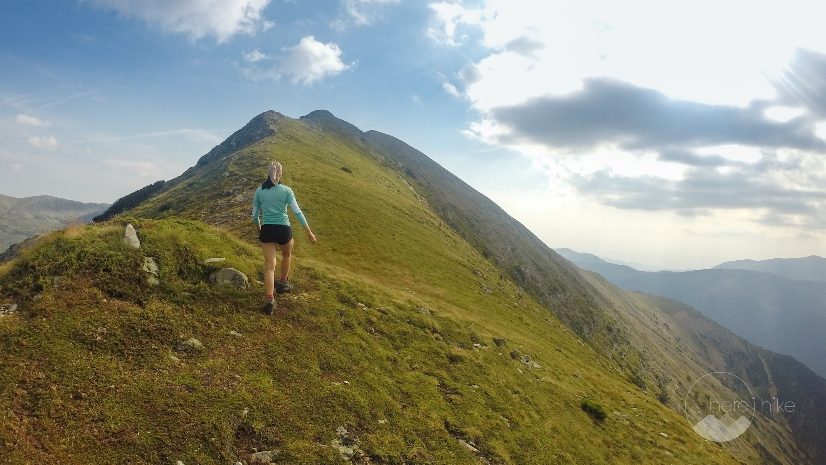
Starting the ascent on the final ridge you should be able to see on your left, right under the peak, Gugu Lake, but you shouldn’t go down to it only if you really want to as the altitude difference is pretty big. After climbing for 20 minutes, you should be on the peak – Gugu – 2291 meters. The view from up there is really nice as you can clearly see all the surrounding high mountains, Retezat, Godeanu, Ţarcu; that being the main reason it is also called the “hidden mountain”.
For the return from the Gugu Peak hike you will have to make your way on the same road, pathing close to the Gugu refuge.

There are a lot of other destinations you can go to in the close vicinity, but consult this overview map of the hiking routes in Retezat.
Check these other close-by hikes:


GPS track to Gugu Peak
How to get to Gugu Peak?
There are multiple access roads to the Retezat National Park, but I will present the one I consider the best if you are coming from the west part of Romania (mainly from Timişoara). The road is great until you reach Clopotiva Village, where you will switch and drive on an industrial, but paved road that ends up at Gura Apelor Dam. From this point, you enter the park road that is unpaved and that requires a car with a decent ground clearance. While an off-road vehicle is ideal for this road you will manage, most of the times, just fine with a normal car. Here is the full road from Google Maps.
After entering in the Retezat National Park and passing the gate you should continue on the dirt road that goes on the edge of the lake until you reach a concrete bridge and an intersection with two possible options. Here you should do a right turn and continue on the edge of lake (don’t go left on the road that goes up the mountain, close to the river, as you will end up at Poiana Pelegii). Continue for 4-5 kilometers while having the lake on your right until reaching a bridge made out of large concrete tubes (there are no other intersections so you can’t miss it). 100 meters before the bridge you will find a small parking place for about 6-7 cars where you should leave your vehicle and start walking.
Where to sleep?
In terms of sleeping you have a few options for camping in the great outdoors but if you want something cozier like a mountain hut there are not that many in the close vicinity. To be honest, the closest huts are about 15 kilometers away. You can sleep in your tent at Gura Apelor Lake or you can hike up to the Gugu Refuge where there is a lot of space around but finding a flat spot is not that easy, but with perseverance you will identify one :).
Also, here at the refuge, you can sleep inside if there is enough room. The facility can easily accommodate 8-10 people and it comes with an outdoor toilet as well. A freshwater spring can be found 5 minutes away so you don’t have to pack that much with you. At the price of 1 more hour walking time you can sleep also at the flat plateau mentioned in the hike description above, the only downside is that you don’t have a water source.

Good to know
You will find a drinkable water source at Gugu Refuge so no need to carry a lot with you. The path to the spring isn’t marked, but hopefully you will find some other people in the area that can point you in the right way. If you are in front of the refuge, with your back at it, you should go in a straight line for like 5 minutes walking time and you should find it in a small valley.
During the summer months, late July and August, the mountain is full of all types of berries, like raspberries, cranberries, blackberries, etc.
Even though, you can basically camp anywhere you wish (as long as you don’t leave any marks or trash) I do strongly recommend you sleep in designated camping places. As you might know the Retezat National Park and the Godeanu Mountain Range are wild areas and the bear population here is in a fair number. Even though, wild animal attacks are not common among tourists (they mainly focus sheep herds) it is good to take precautions. Another recommendation would be to not sleep with food in your tent, try and hang it outside in a tree at a height of 3 meters so no wild animals can reach it. Don’t just keep it outside of the tent on the ground as you will probably not find it there the next morning.
You can build a campfire at Gura Apelor Lake and also up at Gugu Refuge in the camping area, but outside of these places, you risk a high fine from the park rangers.
You can eat only what you bring with you. There are no chalets, shops or restaurants in this part of the Godeanu mountains.
When entering the park you will have to pay an entrance fee that is 10 lei per person (~2.5 euros) and 7 lei per car (~1.5 euros). You only need to pay this once, when entering and there are no daily fees.


Hope you found the information helpful and accurate, but remember, if you have any questions drop them in a comment below!
Other great adventures
-
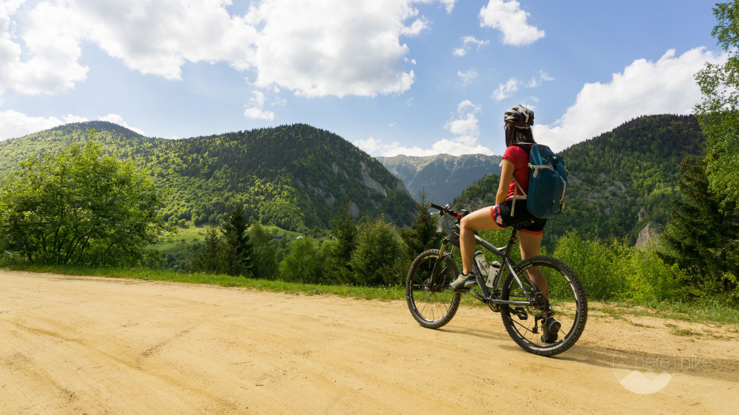
Transylvania MTB Ride: Sirnea
If you’re planning to visit Transylvania, particularly Brasov area and you’re also looking forward to some beautiful mountain biking routes, we totally recommend this one. A nice 50 km ride will enter...
-
Cycling around Dracula’s Castle – Piatra Craiului National Park
Dracula's Castle, an international landmark, is probably one of the most visited places in Romania but we are not going to talk about that. Nevertheless, we are going to talk about the cycling opport...
-
Italian Dolomites: Via Ferrata Giovanni Lipella (4C)
Via ferrata Giovanni Lipella is one of the most emblematic routes in the Dolomites. Not only are the views breathtaking but also the ferrata is a bit more challenging due to its length, altitude and e...
Ruth
Posted at 16:44h, 03 SeptemberWow, looks beautiful there! We will definitely have Romania on our list to visit! One day we will make it there and do this hike. 🙂 Can you do the hike in one day rather than camping the night there?
http://www.travelwithkevinandruth.com
Karina
Posted at 17:58h, 03 SeptemberI'm happy to hear this, Ruth! And to answer your question, yes you can do this in one day but I always prefer to spend the night up in the mountains! 🙂
Aleksandar Veljković
Posted at 01:58h, 21 OctoberThe real adventure is taking a ridge trail over Tarcu all the way to Gugu and then down to lake Gura Apei, but it takes a lot of endurance, and time. You have to sleep in a tent along the way, and bring substantial amounts of food with you, which makes the load on your back quite heavy. I combine travelling in a 4×4 vehicle with hiking because it lets me get closer to some fantastic hiking grounds that would otherwise be very difficult to access – it makes your time management more efficient. But trying to master this huge area in such a combination is really frustrating, because there's only one way, along the Tarcu ridge and then to the southwest where you can pass on wheels. Although the rest of Godeanu mountains (including Gugu) looks kind of hospitable with all the long grassy ridges, there's simply no access for anything but feet. So you have to return the same way you came, that complete ridge crossing that I'm dreaming about stays only a dream. Or several days of hiking with no contact with civilization, if you can endure it. There's something majestic and frustrating in it at the same time 🙂
Karina Isar
Posted at 09:57h, 21 OctoberYou are right Aleksandar, sometimes there is work to do for the infrastructure but sometimes this is just the beauty and wilderness of the trail. Best way to plan such a trail is to leave your car at the destination point and then hitchhike back to the starting point with everything you need in your backpack.
We did a nice tour once, if you are familiar with the area – from Poiana Marului lake up to Tarcu mountains reaching Nedeia, Caleanu and Brusturu peaks and the return in circle back to Poiana Marului. It was a hard one since we did 40 km in 2 days with an altitude difference of +/- 1900 m and had to carry everything with us. But I have to say, it was one of the best. 🙂